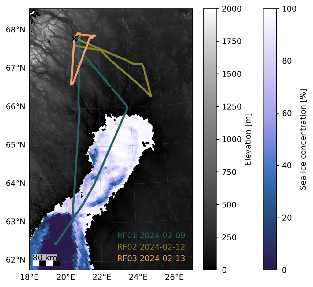
As we reach the midpoint of HAMAG, let’s reflect on the campaign thus far. Our initial three flights have covered the region south and southeast of Kiruna and over the Bothnian Bay. The map below with a digital elevation model and sea ice concentration from the University of Bremen provides an overview of our flight trajectories.
The sea ice concentration map illustrates the closed sea ice in the northern bay and the open ocean towards the south on 9 February 2024. The transect of flight RF01 on this date covered both areas of the Bothnian Bay. Meanwhile, the other two flights focused on low clouds and fog formations over land.
We will continue to update this map to include upcoming research flights.
An overview map of the HAMAG flight tracks with terrain elevation (Berry et al., 2019) and sea ice concentration (Spreen et al., 2008).
In the last week of April, our group participated in the annual EGU General Assembly organized by the European Geosciences Union in Vienna. Around 19,000 geoscientists from 107 countries gathered at the conference to present their latest results. The more than 16,000 presentations covered Atmospheric, Climate, Cryospheric Science, and many more. Furthermore, there were symposia, short courses, and networking events.
For all of us, the EGU conference provided everything for fruitful discussions about our scientific work and potential collaborations. Besides science, it allowed us to meet many new people and friends from other institutes. And finally, Vienna treated us well with Austrian specialties such as Käsespätzle and Kaiserschmarrn during lunchtime.
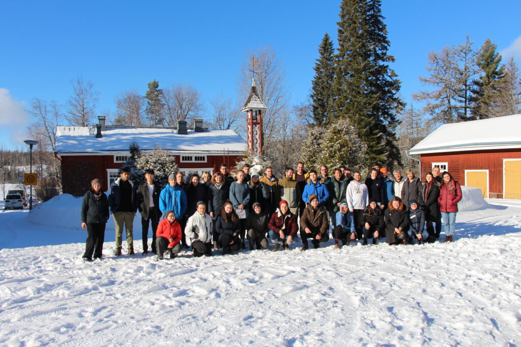
The Transregional Collaborative Research Centre TR 172 (AC)³ and the University of Helsinki organized a joint winter school on Arctic amplification at the Hyytiälä Forestry Field Station in Finland. The field station is located about 200 km north of Helsinki in a boreal forest. This remote place served as the perfect place to learn about state-of-the-art observations of the atmosphere and biosphere.
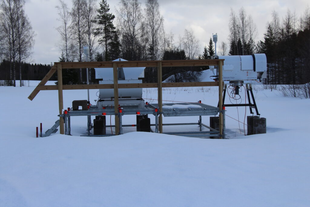
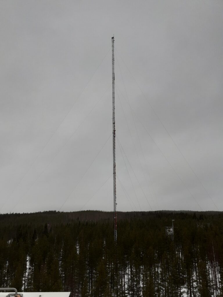
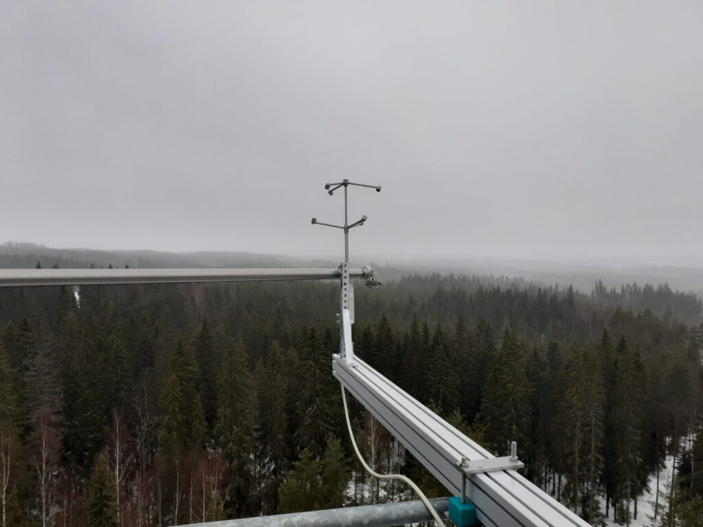
Our daily program consisted of lectures in the morning by scientists from Europe and the U.S. and a combination of group work and field excursions in the afternoon. The lectures covered all research topics of (AC)³: surface energy budget over sea ice and open ocean, cloud microphysics, aerosols, ocean and atmosphere remote sensing, climate feedback mechanisms, Arctic water cycle, atmospheric rivers, and polar-midlatitude linkages. A highlight was an excursion to the meteorological towers that observe for example the formation of new aerosol particles and the deposition of CO₂ by the forest (see photos below).
Group photo in front of the old dining hall. (Photo: Christa Genz)94 GHz cloud radar (left) and microwave radiometer (right) observing clouds, precipitation, and thermodynamic profiles above the boreal forest. (Photo: Christa Genz)The 127 m high tower SMEAR II.A sonic anemometer above the canopy.
During the past decades the Arctic climate is undergoing warming which impacts the local ecosystem and human infrastructure. To better understand the Arctic climate system and improve projections for the future, three aircraft will jointly observe various atmospheric processes over the North Atlantic near Spitsbergen during the HALO-(AC)³campaign in March and April 2022.
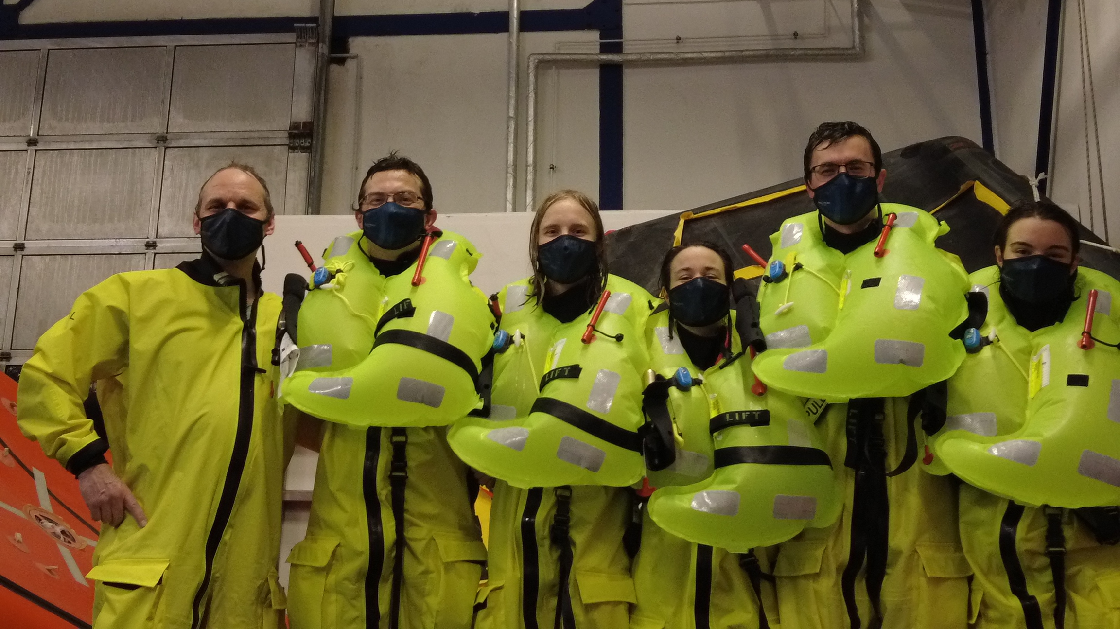
Group picture after the final rescue challenge with survival suits and life vests.
Researchers from our group visited Bremerhaven for an exciting two-day safety training in preparation for this campaign. We learned, how to avoid dangerous encounters with polar bears which actually spend most of their lifetime on the sea ice beneath the aircraft. Additionally, an exhausting sea survival training demonstrated the use of life rafts and other equipment in case of an emergency landing. During the training huge waves and a thunderstorm were imitated, including flashes, rain and thunder in a complete dark surrounding.
Impressions from the sea survival training at RelyOn Nutec in Bremerhaven, Germany.
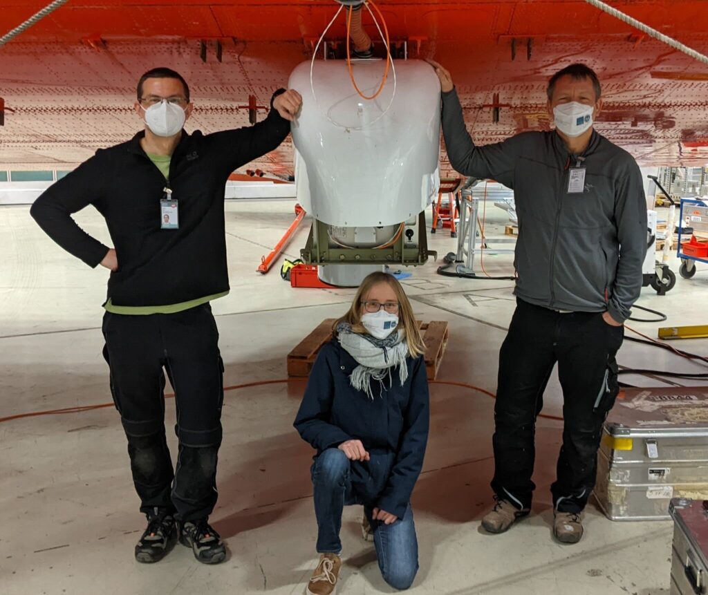
The cloud radar MiRAC-A is mounted below the Polar 5 aircraft.
Moreover, the first instrument belonging to our institute is already mounted below the aircraft Polar 5! It is a radar called MiRAC-A which will detect clouds below the aircraft. The Polar 5 will be equipped with several remote sensing instruments from different institutions. Our working group will additionally install the microwave radiometer HATPRO. Updates on this installation, the calibration of the instruments and the test flights will follow!
Do you want to follow the upcoming activities in the Arctic and learn more about the HALO-(AC)³ campaign? Then follow our AWARES blog and the HALO-(AC)³ website, where updates and interesting background information on the project are provided.