Maria S. Merian Cruise 114/2 – ARC Part 3 – 21.02.23

by Daria Paul and Lennéa Hayo

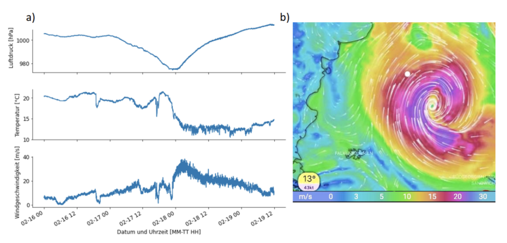
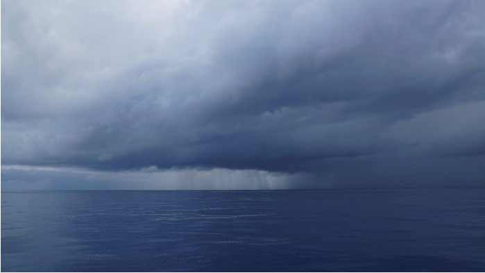
The last few days were quite rough. After crossing the 40° S, we encountered a heavy storm shaking us thoroughly. It gave us wind speeds of up to 140km/h, 12m high waves and rolling the ship from side to side by nearly 45°. Everything on the ship had to be fastened to not go flying about and walking became a real challenge – not even to mention in a straight line.

Luckily the storm weakened after two days bringing the relieve of a good night of sleep again. With the ships movement during the storm even that became impossible, rolling us around in our beds, feeling weightless in one moment and three times heavier than normally in the next.

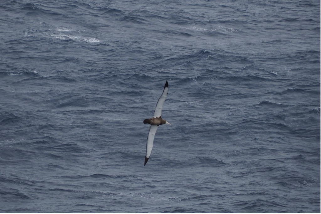
While we are now passing the Falkland Islands and approaching the Magellan Straight, plenty of wildlife is popping up: albatrosses and other flocks of birds have been accompanying the ship since yesterday and some lucky people even saw whales!

Apart from watching wildlife, we are kept busy with writing cruise reports, backing-up data and preparing the instruments for packing. Tomorrow we will reach Punta Arenas and are sad that the campaign is already over. It was great fun working together with the amazing crew of Maria S. Merian, with so many enthusiastic scientists from very different fields, taking measurements in the middle of the Atlantic Ocean and especially very closely experiencing the features that we observed.

1.     An albatross seen from the ship’s observation deck. (Picture by Daria Paul UoC)
Meteorological situation while crossing the storm which had its strongest phase during the night between February 17 and February 18. (a) Air pressure (upper), temperature (middle) and wind speed (lower) measured by the on-board weather station. (b) Windspeed map from windy.de for the morning of February 18. The ship Maria S. Merian is marked by the white dot.

Maria S. Merian Cruise 114/2 – ARC Part 2

by Daria Paul and Lennéa Hayo

Last week, we left the ITCZ and are now heading straight toward Punta Arenas. The new free time, we, therefore, spend with first data analysis. During the third crossing of the ITCZ we for example experienced and measured a strong doldrum with no wind and very little water vapor content in an otherwise very moist environment.

Apart from the data analysis, we used the last few days for two new projects: we launched three more radiosondes during AEOLUS satellite overpasses to help validate its wind profiles and started a little test series with a KT19. The KT19 is a passive infrared “camera” measuring the sea surface skin temperature to estimate the sea emissivity. 

After three weeks alone on the ocean, we saw the first ship on the horizon yesterday since we left the port in Mindelo! As we’re currently approaching the “roaring forties”, we have very rough weather ahead of us the next few days before we cross the “furious fifties” and finally reach the Magellan Strait, where we hopefully have some chances of seeing whales 😊.

Vertical profile of the atmosphere’s relative humidity up to 10.000m within the central ITCZ during the third crossing.
The KT19 sitting at the ship’s bow looks down at the water surface with a special mirror construction. (Picture by Daria Paul, UoC)
Time series of the integrated water vapor (IWV) from the HATPRO as a black line, IWV computed from the radiosonde’s humidity measurements as red dots.

Maria S. Merian Cruise 114/2 – ARC PART 1

Post by Daria Paul and Lennéa Hayo

Two weeks ago, we, Lennéa and Daria, joined the cruise MSM114/2 (ARC) on the RV Maria S. Merian together with an interdisciplinary group of scientists from the MPI-M in Hamburg, the Hafencity University, the University of Cologne, the Royal Dutch Meteorological Institute, and the Polish Academy of Sciences.

The goal is to use the vessels transit from Mindelo on Cabo Verde to Punta Arenas in Chile (23.1. – 23.2.23) to investigate tropical convection within the Intertropical Convergence Zone (ITCZ), which we zig-zagged three times on our way south. On the way, we collect meteorological reference measurements. In contrast, others measure the ocean depth with sonars and conduct CTDs to learn more about the protistan community’s diversity and composition.

We joined the cruise with a microwave radiometer HATPRO (Humidity And Temperature PROfiler). The HATPRO faces the sky and measures microwave radiation emitted by the atmosphere. Through this, we get continuous profiles of temperature, humidity, liquid water content and water vapor content for the entire cruise.

In addition to the radiometer, we help Laura and Julia from Hamburg launch radiosondes every 3 hours during our journey through the ITCZ for ten days. Getting up at 4:30 in the morning to launch the first radiosonde of our shift isn’t particularly easy, but at least it brings the joy of beautiful tropical sunrises!

Sunrise in the ITZC in the middle of the Atlantic Ocean after an early radiosonde launch. (Picture by Lennéa Hayo, University of Cologne)
Launch of a radiosonde by Daria Paul (University of Cologne) (Picture by Olaf Tuinder, KNMI)
Radiosonde launch on Maria S. Merian seen from a drone with sensors for atmospheric profiling (Picture by Daniel Kępski, Institute of Geophysics Polish Academy of Sciences
Heavy rain clouds shortly before leaving the ITCZ during the third crossing. (Picture by Julian Wagenhofer, University of Cologne)