The paths of moisture in the Atacama Desert

In the Atacama Project second phase (2021 to 2024), the A1 group focused on moisture variability and transport into the Namib and Atacama. A comparison between these two deserts allows us to understand the role of the topography in the marked observed differences in moisture, cloud, and rainfall. As the current Namib´s topography resembles the Atacama Desert before the uplift of the Andes, this study also allowed us to understand the slow aridification process that led to extended hyperaridity in the Atacama.

For this purpose, we produced a climatological comparison of water vapor interannual variability and seasonal cycle, including the role of clouds, using state-of-the-art reanalysis ERA5 validated with surface observations.

We found several differences in the atmospheric circulation triggered by the difference in topography. For example, between January and July, the circulation over southern Africa leads to persistent airmass transport from the continent’s interior to the coast. This produces two significant effects: in summer, the easterly winds increase moisture in the free-troposphere, accompanied by clouds and rainfall (Fig. 1a). In autumn and winter, the easterlies are shallower, disrupting the coastal marine boundary layer (MBL), reducing the low clouds near Namib´s coast and inducing frequent clear-sky conditions (Fig. 1b).


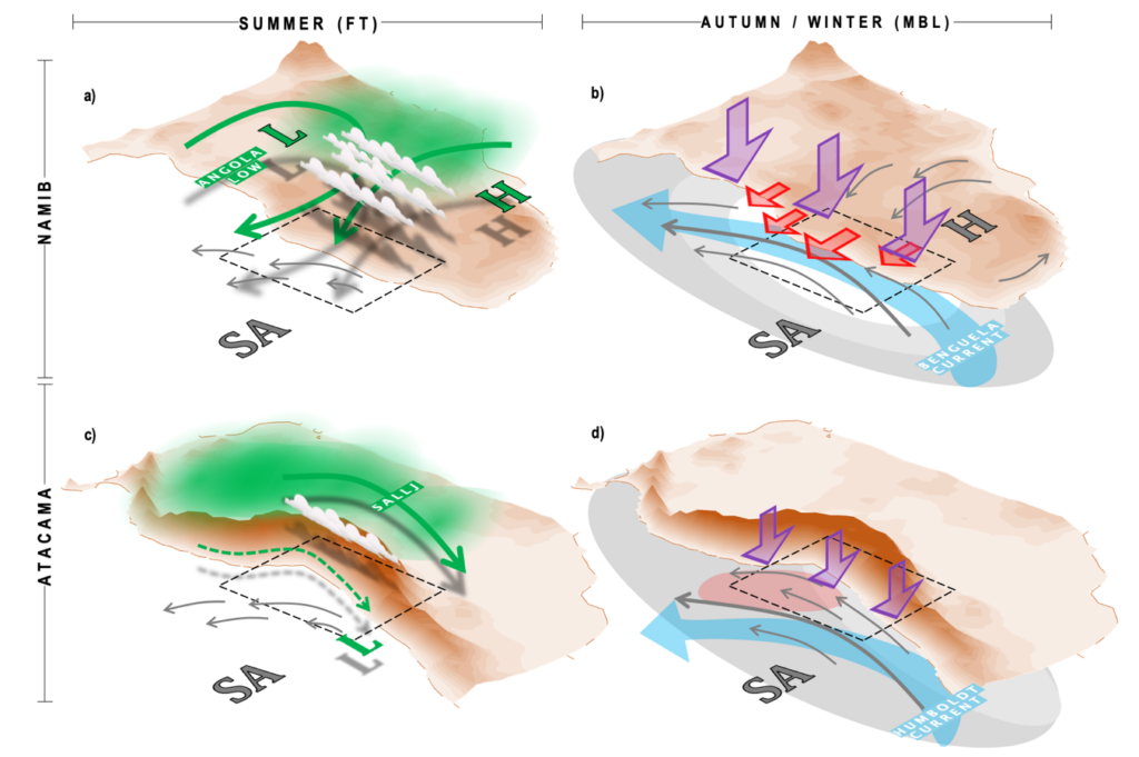
Figure 1. Schematic figure of the main features associated with changes in water vapor and clouds for summer (DJF) in the free-troposphere (a,c) and autumn (MAM) and winter (JJA) for the boundary layer (b,d). In the left panels: the circulation pattern at 850–750 hPa in green arrows. Green thick and thin-dashed arrows represent strong and weak water vapor transport, respectively. We included the position of the main low (L) and high (H) pressure systems, as well as the South American Low-Level Jet (SALLJ). In the right panels, boundary layer winds are plotted with gray arrows. The stratocumulus cover is represented with gray shades, with darker tones indicating more clouds and white less clouds. The Benguela and Humboldt currents are shown by clear blue arrows and warmer SSTs in clear red. Warmer air in the upper MBL/lower FT is represented by red arrows and the subsidence intensity in purple arrow. We included the position of the Subtropical Anticyclones (SA) and the continental high-pressure systems (H) [Vicencio et al., 2023]

In the Atacama, the Andes block almost any exchange of air mass between the Pacific Ocean and the continent’s interior. In summer, moisture from the Amazonas is directed southeast of the Andes, leading to a drier free-troposphere in the Atacama compared to the Namib (Fig. 1c). The absence of the easterlies on the Atacama’s coast maintains year-round a well-developed MBL, with a higher proportion of low clouds than Namib despite the weaker low-level stability and warmer SST (Fig. 1d).

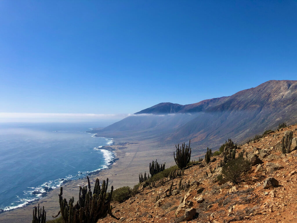
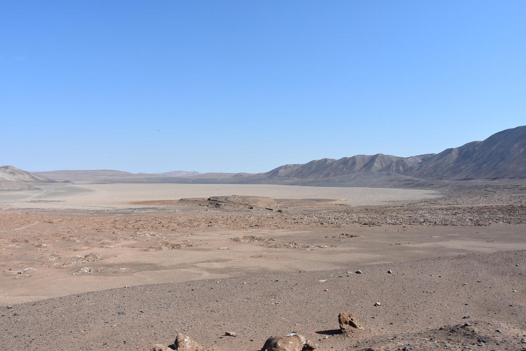
The impact of topography on rainfall can also be interpreted by comparing both desert’s current climates. The most rainfall in Namib is observed between summer and autumn due to the effect of the easterly winds. The Atacama lacks this feature, reducing the wet period only to winter. Therefore, it is highly likely that the Atacama observed a similar rainfall pattern as in the Namib nowadays before the uplift of the Andes around 20 Million years ago. Continued uplift of the cordillera likely intensified the aridification of the desert’s interior by blocking moisture transport from the interior of South America, leading to the extreme drier conditions observed nowadays on the coast and central depression, where the annual rainfall rates ranges barely between 0.25 and 5 mm.

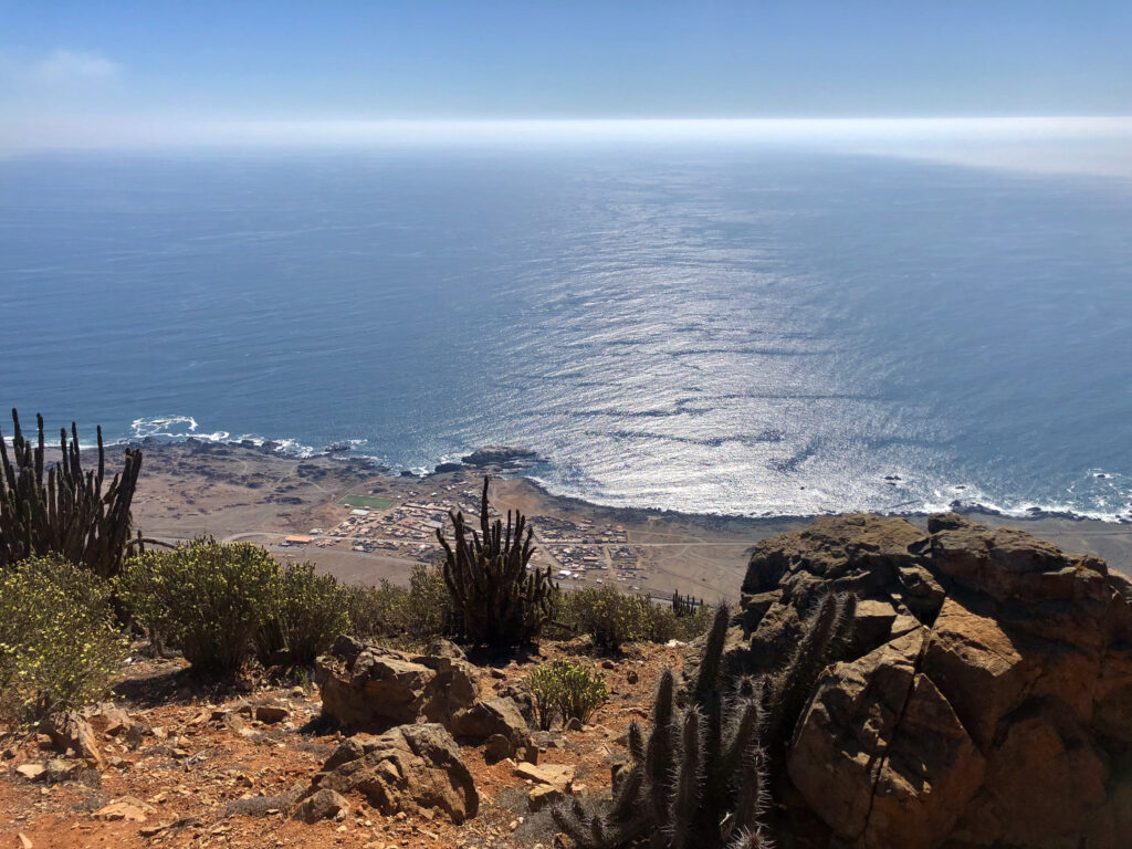
Despite the extreme hyperaridity in the Atacama, moisture finds its way to the core of the desert. Using surface-based weather stations and Large Eddy simulations with the ICON-LEM model for a typical winter day, we found that moisture from the MBL crosses the coastal mountains through certain valleys (Fig. 2). Most of this transport occurs in the afternoon-evening and reaches the slopes of the Andes but not further. This moist air remains in valleys and basins during the night, where nighttime cooling eventually leads to fog formation. At the onset of the circulation in the morning and noon hours, convergence at the surface leads to the injection of moist air in the atmosphere above the surface boundary layer. From here, it is transported further south by the mid-troposphere circulation. Reanalysis data suggest that this feature is relatively common in austral winter.


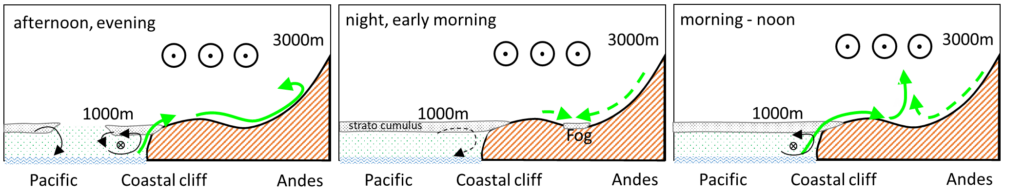
Figure 2: Schematic of the diurnal circulation. Green arrows indicate water vapor transport from the maritime boundary layer into the desert. The weaker nighttime downslope flow is marked with dashed lines. Circles with dots at 3km height indicate a northerly, moist flow transporting moisture to the south. [Figure created by Dr. Jan Schween and modified from Schween et. al 2020]

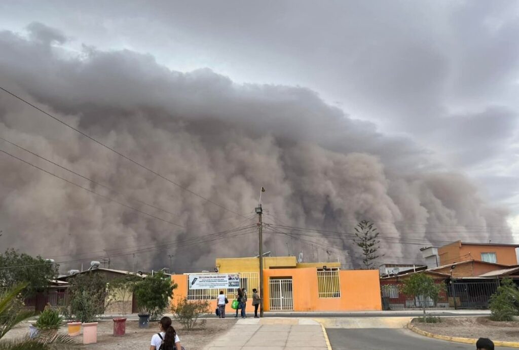
Additionally, we found that moisture also finds its way in summer. This time, thanks to a weak but climatological moisture transport structure (Fig. 1c) in the lower free troposphere offshore southern Perú and northern Chile, bringing the humidity from the tropical eastern Pacific to the desert. We named this mechanism as moist northerlies (Vicencio et al., in review). Once the humidity reaches the Atacama´s coast, it is transported inland by the Rutllant cell. This pattern sometimes leads to extreme precipitation events across the Atacama and precordillera. In recent decades, the number of summer rainfall episodes linked with this mechanism has increased, reaching a peak in 2020.

The key mechanism for this moisture intrusion into the desert is the southward shift of the subtropical anticyclone, which is associated with the expansion of the Hadley cell due to human-induced greenhouse gas emissions. Therefore, it is highly likely to continue observing similar rainfall events in the next decades over the Atacama, increasing moisture availability via transport, rainfall and clouds.

Note: This post was originally written and edited by Jose Vicencio and Jan Schween for the Atacama Project Website.

An excursion to the driest desert in the World: Part I

The sharp topography is just one of the characteristics of the Atacama Desert

In October 2022, a group of biologists, geologists, geographers and meteorologists travelled to the Atacama Desert in northern Chile, the driest desert in the World.

This travel is under the umbrella of a big German project called CRC-1211: Evolution at the dry limit. The aim of the project is to understand how the life and landscape evolves in this hard environment condition, as well the interaction with the geological and meteorological processes.

The Atacama Desert lies between the bast Pacific Ocean and the Andes Cordillera, featuring low atmospheric humidity, scarce precipitation and almost no clouds. However, clouds do reach the Atacama, especially at the coast, thanks to the presence of an almost semi-permanent stratocumulus deck in the southeast Pacific. 

Next to the coast, the coastal cordillera (ranging between 800 and 1200 m ASL) “captures” these clouds, blocking the way to the interior of the desert. 

In the next time-lapse video, you can see clearly the coastal air trapped in the lower part of the atmosphere, something we called the Marine Boundary Layer (MBL). Here, the air is rather misty, full of marine aerosols that tend to produce a more foggy view of the landscape. This marks a big difference with the strong-blue, clear skies above in the free-troposphere. 

The MBL is capped by some clouds at ~1.000 m ASL, matching the coastal cordillera’s height, thus bringing liquid water in form of fog deposition or dew, especially during the night and the morning. In fact, this is almost the only source of liquid water for life because rainfall only happens every few years.

Time-lapse of the marine boundary layer along the coast of Atacama. The clear and dry from above contrast with the area with more aerosols and some clouds. Video: José Vicencio. October 2022.

More impressive, some plants are capable of surviving in these areas, only capturing the water from the clouds. In the next video, you can see the crown jewel of biologists: the Tillandsia. Because it is impossible to get water from the ground, this little bush does not develop any roots. Instead, it grows horizontally forming dunes that face the wind direction, allowing to capture of water that comes from the coast with the clouds.

Time-lapse of the clouds arriving to the Tillandsia field in the late afternoon. Video: José Vicencio. October 2022.

As was mentioned before, these plants are able to grow in curvy shapes over small dunes, facing the main wind direction and therefore maximizing the water capture.

Tillandsia field using a drone. Photo: Dr. Fabian Reddig.default
Dr. Johanna Möbus (B01 – Heidelberg Uni.) walking in the Tillandsia Field with the clouds approaching in the back. Photo: José Vicencio.
The Pacific Ocean and the small town of Paposo. Photo: José Vicencio.

The Atacama’s coastal cordillera is spectacular. Life blooms with just a few millimeters of cloud water, even in a dry and warm environment like this.

Along the coast, the main cities also grew, attracting people from all over the world due to the fishing, mining and tourism.

“La Portada” monument, a classic spot to visit in Antofagasta, Chile.

American Meteorological Society (AMS): The return of face-to-face conferences

When the COVID-19 pandemic started, scientist around the world migrated quickly to online meeting and zoom conferences. However, if there is something that we all can conclude after this experience, it is the fact that nothing can replace the experience of face-to-face meetings. Not only because of the interactions between the colleagues and scientific discussions that take places everywhere, but also the experience to visit different places, cities, and cultures. Next, you can read the experience of Kerstin Ebell, member of AWARES:

In August, Susanne, Rosa and me went to the American Meteorological Society (AMS) Collective Madison Meeting at Madison, Wisconsin. The conference collection was about cloud physics, polar meteorology and oceanography, atmospheric radiation and satellite applications. After 2 years, this was my first international travel, and I was very excited to go. It was really great to meet international colleagues again and see old and new faces!

We had very good discussions during and around the conference and could enjoy the city of Madison (with an impressive water ski show!) and the hospitality of our American colleagues. My non-conference highlight was the corncob that we had for dinner at a friends place. So delicious! Sometimes the simplest things are the best things in life…

Conference link: https://www.ametsoc.org/index.cfm/ams/meetings-events/ams-meetings/collective-madison-meeting/

March 2022: A strange month in the Atacama Desert

The Atacama desert is one of the driest places in the world. However, most of March 2022 experienced humidity, clouds, and even rainfall. You don’t believe us? Here, we collected some evidence of this strange month in the Atacama.

Rainfall bands observed between Salar de Huasco and Pica, Tarapacá Region, Chile. The photo was taken by the PhD student Bárbara Vargas-Machuca, on March 9, 2022, during an excursion funded by the Collaborative Research Center 1211: Earth – Evolution at the dry limit.

In the middle of this dry desert, rain bands were observed on March 9 2022, near a location called Pica (20ºS, Tarapacá Region), around 1100 m above sea level and in the core of the Atacama. During that day, between 0.8 and 5.2 mm were recorded across the desert in different weather stations, with some thunderstorms, showers, drizzle, and plenty of clouds.

On March 16 2022, storms developed once again in the Atacama, this time near the major city of Calama (22.5ºS, Antofagasta Region), producing heavy rainfall, floods, and some damages on houses and roads. In less than 2 hours, rainfall accumulated between 1.2 and 7.2 mm in the city. The next pictures were taken at the city airport (El Loa) and show the presence of a huge convective system (left) and rain bands (right). In fact, the roof of the city airport was damaged due to the downpour.

Storm developing close to El Loa Airport at 22:20 UTC on March 16, 2022. Source: DGAC.

The next day, on March 17 2022, new storms developed with even more intense rainfall, accumulating up to 15 mm near the city of Diego de Almagro (26ºS, Atacama Region). However, the story does not end here. In addition to the thunderstorms, a huge sandstorm was observed crossing the Atacama valleys, engulfing several towns (see the next picture) and capturing the attention of the whole country. Even more unusual than rainfall, sandstorms of this magnitude are rarely seen in the Atacama.

Sandstorm approaching Diego de Almagro on March 17, 2022. Source: @radiocoquimbo

We know that any kind of storms and rainfall are originated from water vapor. Because the Atacama is so dry in terms of humidity, we usually don’t observe any hydrometers in its inner core. However, the events described in this post highlight the presence of more humidity than normal. What we do not know in this matter, for example, is how much water vapor excess was observed? Why the month of March 2022 was more humid than expected in the Atacama? Where does this humidity come from? How the humidity is spread in the desert and interact with the topography? Thus, some questions remain unanswered yet, but future works in our working group will try to unravel this mystery.

Amazon Basin waters the driest desert on Earth

The Atacama Desert is the driest place on Earth aside from the poles with annual rain rates below 2 liters per square meter. For comparison, Cologne, Germany, receives around 800 liters of precipitation per square meter each year. The water delivered to the Atacama through the very rare rain events takes a surprising path. It originates from the moisture pool above the tropical rain forest of the Amazon Basin, travels more than 2000 km including a crossing of the Andes and reaches the Atacama from the northwest.

The Atacama Desert is the driest place on Earth aside from the poles. Enduring dryness conserves traces of surface alterations over thousands of years. Photo: Jan Schween
My research goal is to determine atmospheric water supply mechanisms which feed this unique ecosystem. This will help to determine the thresholds of life at the dry limit and is important to recreate climate history.

The water is transported in filamentary structures at roughly 4 km height which are called moisture conveyor belts. These weather phenomena cause about 40% to 80% of the total precipitation in the Atacama. About four moisture conveyor belts make landfall along the coast of the Atacama each year. While some bring only very little precipitation to a limited region, some can result in strong flooding events or trigger major biological outbursts. For instance, in June 2017 a moisture conveyor belt brought over 50 liters of rain per square meter which exceeds the tenfold annual rate. In other words, it is a decade worth of rain within a couple of hours. A few weeks later, the spectacular blooming desert enchanted scientists and tourists.

Such extreme events typically leave traces in the landscape for thousands of years. The findings of our study will affect the interpretation of geological archives which reflect on such traces. The improved understanding of current water supply mechanisms will help to reconstruct climate history more genuinely which is one of the major goals of the Collaborative Research Center 1211: Earth – Evolution at the dry limit.