RF06 – another survey to the frozen Gulf of Bothnia

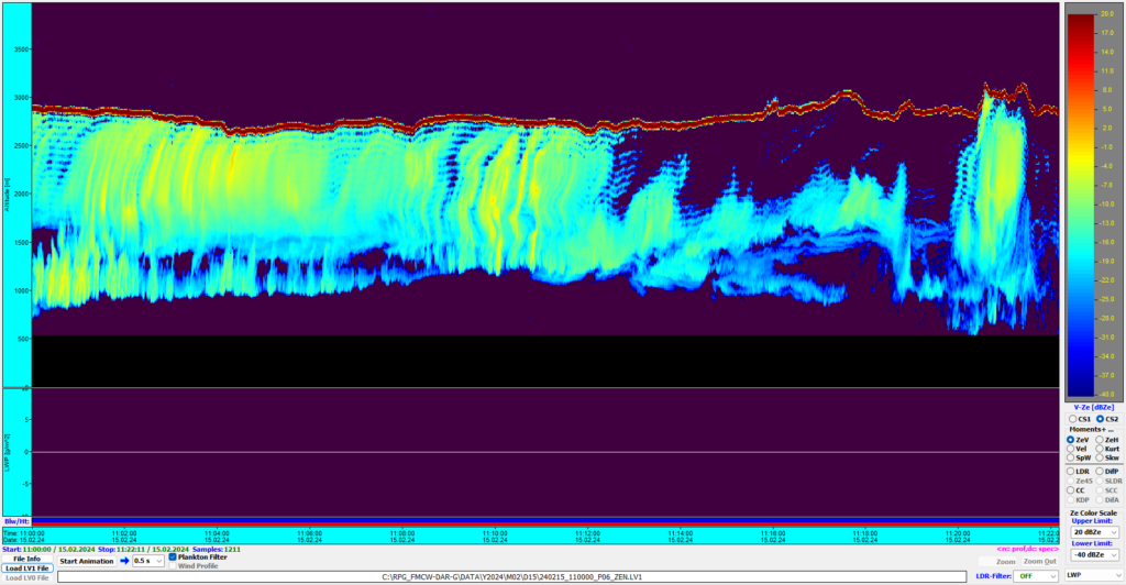
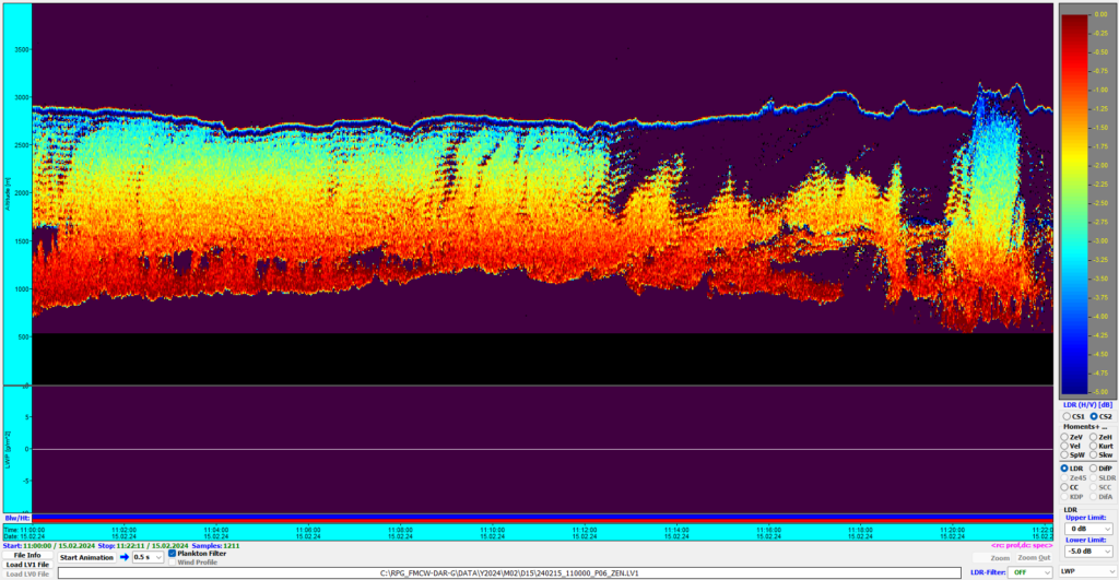
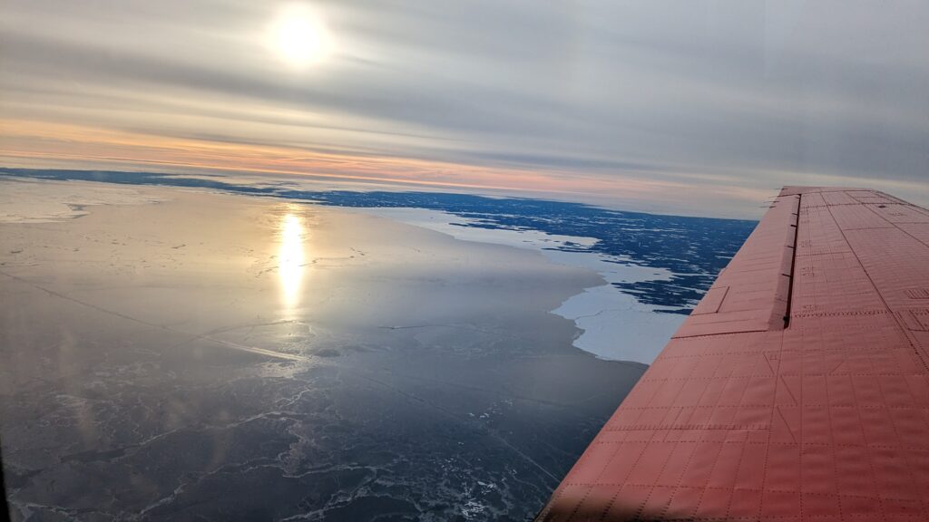
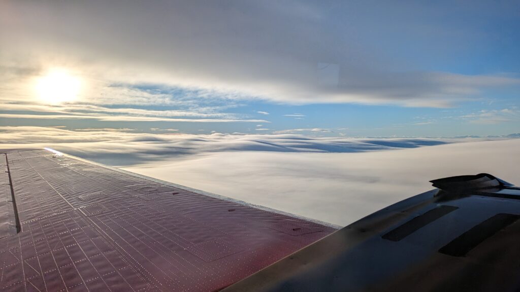
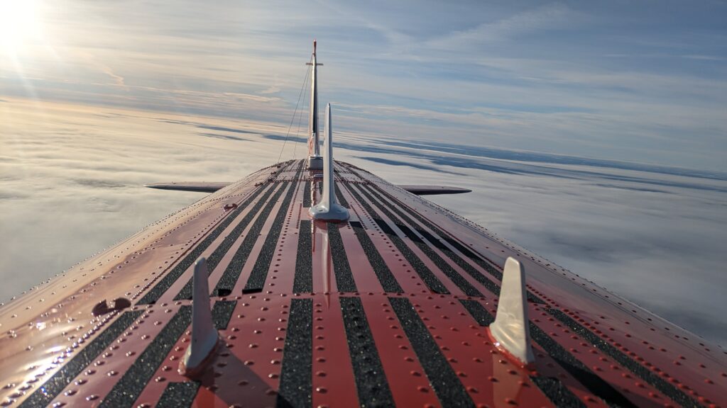
Today’s research flight was a repetition of RF01 cruising down the Gulf of Bothnia from its northern end down South till we reach the cloud decks that usually form over the open ocean. This year’s ice extension is quite large and it takes us more than one hour to get there. Since the models did not forecast any clouds over the ice in the bay, we planned to use this section for sea ice emissivity measurements. But in contrast to the forecast we could see low clouds covering the ice surface, giving us the chance to see how the new radar performs on these.

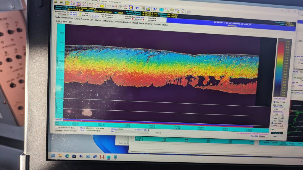
Very thin clouds lying on the ground could not be seen, neither by the G- nor by the W-band radar. But very interestingly, the surface return and the patterns of ghost images changed as soon as clouds were in the beam width.

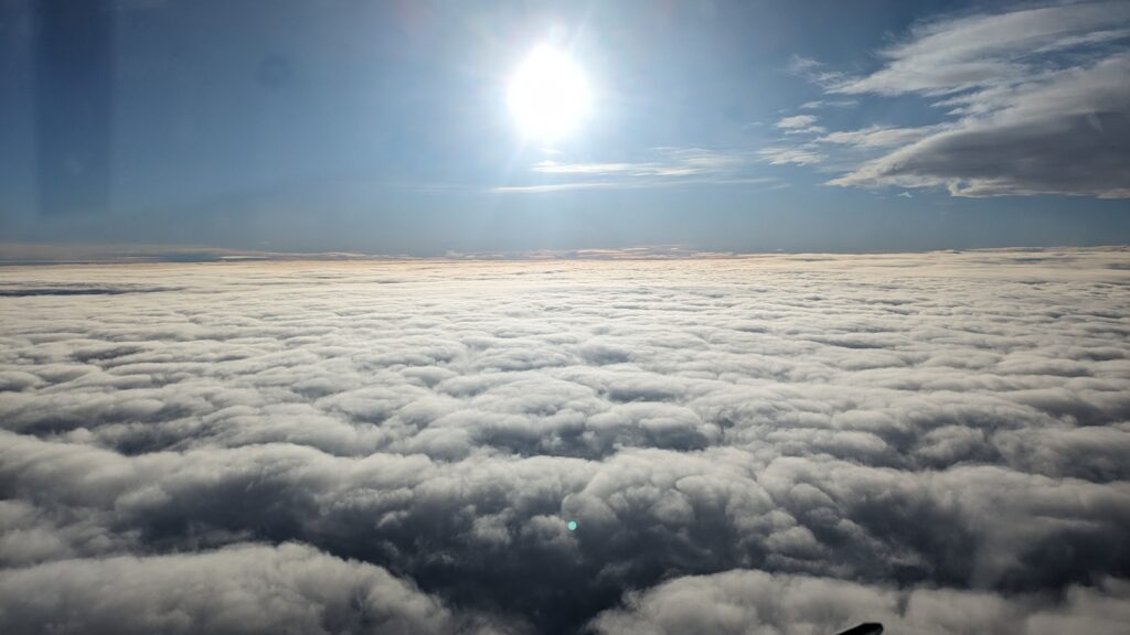
Cruising along the bay we reached thicker clouds organized in several layers. Between the layers, seeder-feeder effects could be seen in the radars as well as DAR signals of up to 7 dB. All in all another very successful flight with a lot of knowledge on our new GRaWAC radar.

Meet the HAMAG team

Before some of us left the team, we took the chance to take a picture of the HAMAG crew in front of our reliable research platform Polar 6 in Arena Arctica. In the middle underneath the fuselage, you can see the belly pod carrying our two radars, GRaWAC and MiRAC.

Outlook for tomorrow. For the first time, we will try a survey on the Norwegian coast.

RF04 – the day we were waiting for

It’s not a surprise, that when you are looking for clouds to measure, it is very likely that you find them as well at the airport you plan to operate from. That’s what we had to deal with today. But pilots were convinced that it was doable, we did it, and it turned out to be the day that you do not want to miss.

It has always been the plan to stay local and find a good cloud deck to test different radar settings and get the first real differential absorption signal from the two GRaWAC channels. We found suitable clouds East of Kiruan on a 100 nm North-South leg that we followed four times before being back at Kiruna after about 4.5 hours. The data we collected look beautiful and should be the ones we needed to make this campaign a full success.

RF03 – sensing the low-level clouds with different settings

Today’s flight planning and go or no-go decision have not been easy. The overall situation has been similar to yesterday’s with haze all over Northern Sweden and Finland and the area around Kiruna airport showing a sunny sky with broken low-level clouds only, but with a forecast saying low visibility and difficult landing conditions throughout the day. After long discussions, we decided to go for a short survey, staying local to test different settings for GRaWAC to sense the low-level haze.

Up in the air, we tried different settings with the radars to see which works best with the thin haze. Although the haze was very thin and the ground was visible, both got a signal from time to time. To get an idea of temperature and humidity stratification, two dropsondes have been launched.