Installation of the radar and radiometer on P5

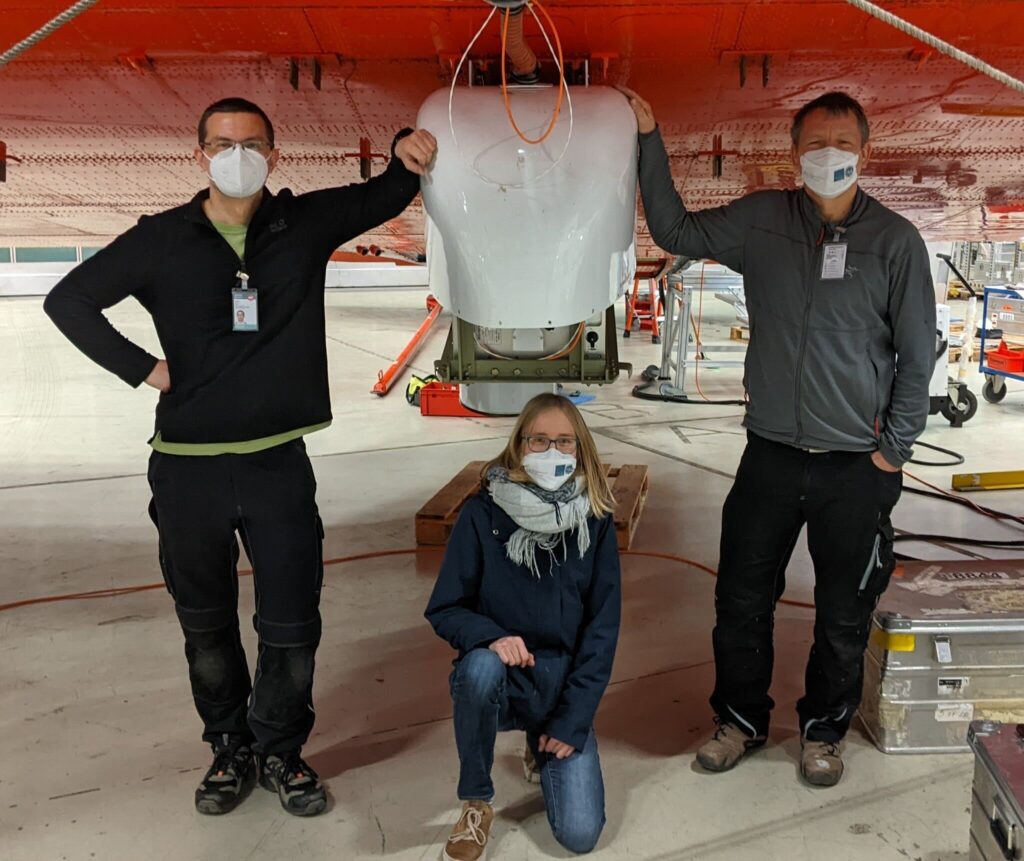
Last week we installed the radar MiRAC and radiometer HATPRO on the Polar 5. The whole installation took us three days, but the following time lapse video gives you an overall impression in only two minutes!

The video first shows the installation of the radar MiRAC which is covered by a belly pod below the aircraft. Then the screwing together of the HATPRO is shown.

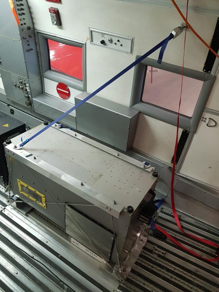
MiRAC is a frequency-modulated continuous wave (FMCW) radar, an active remote sensing instrument, operating at 94 GHz with an additional microwave radiometer, which is a passive remote sensing instrument, recording at 89 GHz. The radar is hanging below the aircraft and is protected by a belly bod. The bottom of the pod has a hole so that the antennas of the instrument are able to transmit and receive microwave radiation. The transmitted signal is reflected by cloud droplets or the surface and received by the antennas again. These signals help us to detect clouds and to interpret their microphysical properties.

The radiometer HATPRO is installed inside the aircraft and is looking through a hole in the ground of the aircraft. HATPRO measures microwave radiation emitted by the surface and atmosphere below Polar 5. These observations contain information on the atmospheric humidity, precipitation, liquid water in clouds, as well as on the surface.

HATPRO inside the P5.

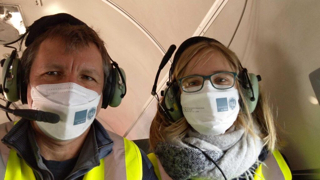
After the installation, it was time for a ground test, during which all instruments inside the P5 were connected to the aircraft electricity one after the other. Unfortunately, this did not work out as planned and after some minutes no electricity was available in the aircraft anymore. Nevertheless, the engineers repaired everything and the ground test could be completed successfully the very next day!

Before taking off to the Arctic, the instruments had to be tested during the flight as well. Thus, the first short flight took place over the North Sea and Helgoland. Luckily, all instruments on board worked properly!

Communication during the flight is only possible with a head set.

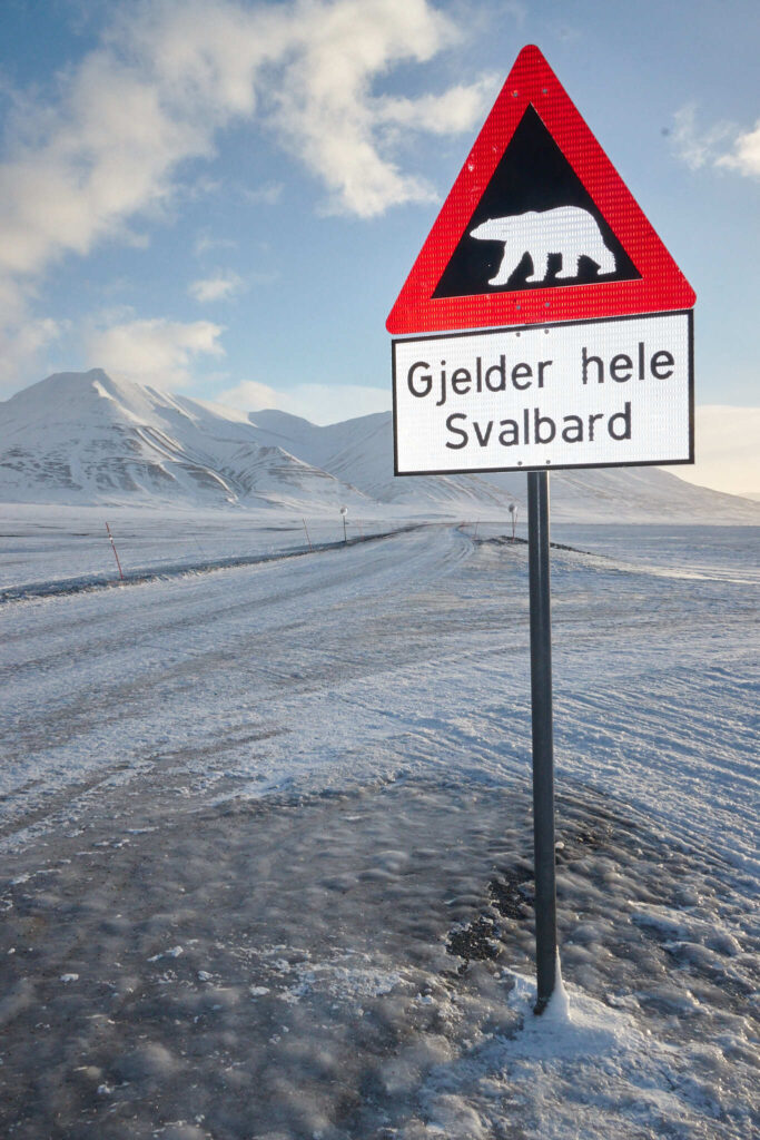
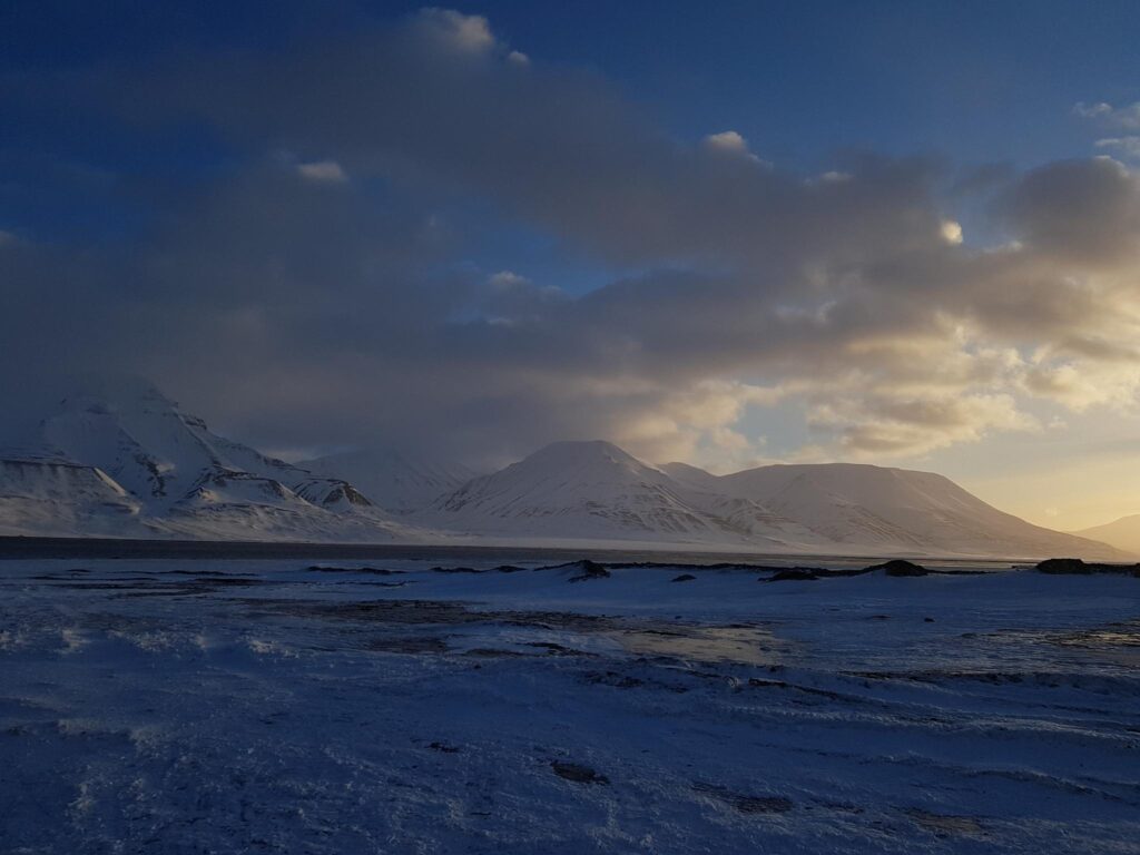
After the success in Bremen, we had to quickly pack our luggages. At the beginning of the week the great journey to the Arctic started. After a stop in Oslo and Tromsø, we arrived in Longyearbyen on Tuesday! Since then we are waiting for the Polar 5 and 6 and use the time to explore the area and plan the first research flights. We expect the aircraft to land in a few hours and will give an update on the arrival soon!

Great view over the fjord.

To stay up to date, check Twitter for the latest information! #HALOAC3 #AC3TR #MiRACradar #polar5 #Svalbard

#AC3 #funding #ArcticAmplification (AC)3 AISAM Arctic Atacama Atmospheric boundary layer AWI Bremenhaven AWIPEV AWIPEW CFMIP-GASS climate cloud radar cloud radars clouds COST gender gap GEWEX HALO HALO-(AC)³ HAMAG HATPRO hyperarid ITCZ JOYRAD94 Kölnische Rundschau Maria S. Merian MiRAC-A model intercomparison Ny-Ålesund outreach Polar 5 Polar 6 PolarStern Precipitation PROBE COST Action radiosondes STEM STEMM Svalbard tropical convection videodocumentary Water Vapor Wetoo Winter school women in science

How to prepare for an Arctic campaign (part 2)

Part of preparing for a climate study in the Arctic involves preparing for polar bear emergencies.  Blog followers will ask themselves: wait, but aren‘t we flying? Yes! But…safety training includes polar bear protection, as emergency landing on the ice is (an unlikely) possibility.

An image from the Arctic landscape… and a typical road sign in that region (photo credits: Pavel Krobot)

The ice is the home of the polar bears. Bears are very curious, and extraordinarily well adjusted to the Arctic environment. For a polar bear, a group of scientists means a great opportunity for some extra dinner. So even though many of us are faced by comments around „You‘re going to the Arctic: I hope you will see a polar bear“ we actually really want to avoid seeing one (other than from the plane).

But you never know, so better to prepare for the emergency case.  This is why 6 of us spent a day at AWI Bremerhaven to learn about polar bears and their behaviors.   We learned how to avoid meeting a bear, how to scare bears (hint: they don‘t like loud noises, including banging on cooking pots), and what to do when you see one from far away. For the troubling worst-case scenario of a bear attack, we were also trained on how to handle a rifle.

Insights from the group include: rifles are surprisingly heavy; we were lucky to have Arctic-like wind conditions as storm „Ylenia“ was passing the Bremerhaven area during our training; and fingers crossed for spotting a bear from the air!

#AC3 #funding #ArcticAmplification (AC)3 AISAM Arctic Atacama Atmospheric boundary layer AWI Bremenhaven AWIPEV AWIPEW CFMIP-GASS climate cloud radar cloud radars clouds COST gender gap GEWEX HALO HALO-(AC)³ HAMAG HATPRO hyperarid ITCZ JOYRAD94 Kölnische Rundschau Maria S. Merian MiRAC-A model intercomparison Ny-Ålesund outreach Polar 5 Polar 6 PolarStern Precipitation PROBE COST Action radiosondes STEM STEMM Svalbard tropical convection videodocumentary Water Vapor Wetoo Winter school women in science

From: Sabrina Schnitt

How to prepare for a campaign in the Arctic?

During the past decades the Arctic climate is undergoing warming which impacts the local ecosystem and human infrastructure. To better understand the Arctic climate system and improve projections for the future, three aircraft will jointly observe various atmospheric processes over the North Atlantic near Spitsbergen during the HALO-(AC)³ campaign in March and April 2022.

Group picture after the final rescue challenge with survival suits and life vests.

Researchers from our group visited Bremerhaven for an exciting two-day safety training in preparation for this campaign. We learned, how to avoid dangerous encounters with polar bears which actually spend most of their lifetime on the sea ice beneath the aircraft. Additionally, an exhausting sea survival training demonstrated the use of life rafts and other equipment in case of an emergency landing. During the training huge waves and a thunderstorm were imitated, including flashes, rain and thunder in a complete dark surrounding.

Impressions from the sea survival training at RelyOn Nutec in Bremerhaven, Germany.
The cloud radar MiRAC-A is mounted below the Polar 5 aircraft.

Moreover, the first instrument belonging to our institute is already mounted below the aircraft Polar 5! It is a radar called MiRAC-A which will detect clouds below the aircraft. The Polar 5 will be equipped with several remote sensing instruments from different institutions. Our working group will additionally install the microwave radiometer HATPRO. Updates on this installation, the calibration of the instruments and the test flights will follow!

Do you want to follow the upcoming activities in the Arctic and learn more about the HALO-(AC)³ campaign? Then follow our AWARES blog and the HALO-(AC)³ website, where updates and interesting background information on the project are provided.

To stay up to date, check Twitter for the latest information! #HALOAC3 #AC3TR #MiRACradar #polar5 #Svalbard

Price for communication awarded to video on atmospheric boundary layer!

On Wednesday 16 February 2022, the video “Atmospheric boundary layer: the layer where we live” received a prize in a contest organized by the Italian Meteorological Association (AISAM) as part of their fourth National Congress, held in Milan, Italy. The congress offers the opportunity for the Italian scientific community dealing with atmospheric sciences, meteorology, and climatology to promote reflections on these issues.

The innovative graphics in the video explains in an intuitive way what happens in the atmospheric layer closest to the Earth surface, where we all live. The atmospheric boundary layer (ABL) is the layer closest to the Earth’s surface within which most human activities take place.

The video was funded by the PROBE COST action, a network of European scientists working on profiling the atmospheric boundary layer using remote sensing instruments. So why are we posting it here? Because the video was realized by the science communication manager of the action, Claudia Acquistapace, who is a researcher working in the AWARES group.

The vertical profile of atmospheric thermodynamic parameters in the ABL impacts weather, air quality, and climate. Surface sensor networks and satellite observations do not provide sufficient information on the high temporal variability and strong vertical gradients experienced in the ABL.

What do you think about the video? Do you like it? Do you have comments? let her know, she is eager to improve. You can also contact her (cacquist@meteo.uni-koeln.de) if you want to get to know how to practically realize a video like this… or simply you are curious or how much it cost 🙂

Amazon Basin waters the driest desert on Earth

The Atacama Desert is the driest place on Earth aside from the poles with annual rain rates below 2 liters per square meter. For comparison, Cologne, Germany, receives around 800 liters of precipitation per square meter each year. The water delivered to the Atacama through the very rare rain events takes a surprising path. It originates from the moisture pool above the tropical rain forest of the Amazon Basin, travels more than 2000 km including a crossing of the Andes and reaches the Atacama from the northwest.

The Atacama Desert is the driest place on Earth aside from the poles. Enduring dryness conserves traces of surface alterations over thousands of years. Photo: Jan Schween
My research goal is to determine atmospheric water supply mechanisms which feed this unique ecosystem. This will help to determine the thresholds of life at the dry limit and is important to recreate climate history.

The water is transported in filamentary structures at roughly 4 km height which are called moisture conveyor belts. These weather phenomena cause about 40% to 80% of the total precipitation in the Atacama. About four moisture conveyor belts make landfall along the coast of the Atacama each year. While some bring only very little precipitation to a limited region, some can result in strong flooding events or trigger major biological outbursts. For instance, in June 2017 a moisture conveyor belt brought over 50 liters of rain per square meter which exceeds the tenfold annual rate. In other words, it is a decade worth of rain within a couple of hours. A few weeks later, the spectacular blooming desert enchanted scientists and tourists.

Such extreme events typically leave traces in the landscape for thousands of years. The findings of our study will affect the interpretation of geological archives which reflect on such traces. The improved understanding of current water supply mechanisms will help to reconstruct climate history more genuinely which is one of the major goals of the Collaborative Research Center 1211: Earth – Evolution at the dry limit.